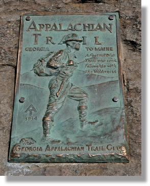


The Appalachian Trail is a continuous marked footpath that goes from Springer Mountain in Georgia to Katahdin in Maine, a distance of approximately 2160 miles.
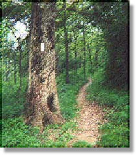
The trail from FS 42 to the top of Springer Mountain is the shortest approach to starting point of the trail.
The southern terminus of the Appalachian Trail lies almost exactly in the middle of a line drawn from Ellijay to Dahlonega. Springer is one of the few places in Georgia never forested, mostly because the ground is so rocky that trees don't grow well in the soil. This made it less than worthwhile for companies to attempt to harvest what little lumber there is on top of the mountain.
History of the Appalachian Trail
The conservation movement in America was launched from Teddy Roosevelt's "Bully Pulpit" shortly after the turn of the 20th century. In the northeast numerous proposals had been made prior to 1921 to create a "super" trail.
"An Appalachian Trail: A Project in Regional Planning" by Benton MacKaye was published in the Journal of the American Institute of Architects in October of 1921. The original proposal was for a footpath to run from the highest point in the northern Appalachians (Mt. Washington, New Hampshire) to the highest point in the southern Appalachians (Mt. Mitchell, North Carolina). Within a year work began on "America's Footpath." First completed was the section that ran from Pennsylvania to Connecticut across the new Bear Mountain Bridge.
By 1925 the dream began to move towards reality with the creation of the Appalachian Trail Conference. The proposed route was extended to run from Maine to Georgia, originally to "Cohutta" Mountain. Since little was known by the developers about the North Georgia mountains they planned the trail from maps. Roy Ozmer, woodsman and friend of Georgia Ranger Arthur Woody was put in charge of exploring the area from Virginia to Georgia. These men felt that Mount Oglethorpe, east of Jasper, was a better choice for the end of the Appalachian Trail.
Once the route in Georgia from Bly Gap to Mount Oglethorpe was established, Woody assisted personally and assigned Forest Service employees to assist in the construction which was completed in 1931. In 1937 the trail was completed with the clearing of the last 2 miles between Spaulding and Sugarloaf Mountains in Maine. At the time the trail stretched from Mount Katahdin in Maine's Baxter State Park to Mount Oglethorpe in Georgia. The trail, as envisioned, was a "sky-line" trail, going from high-point to high-point, along the highest route available.
During the next few years the trail fell into disrepair because of hurricanes, war and neglect. In 1938 a hurricane that swept up the coast did heavy damage to America's "First Trail." The connection of the Skyline Drive to the Blue Ridge Parkway in the 1940's displaced a section of the trail 120 miles long. Slowly, portions of the trail were being reclaimed by nature.
In the early 1950's interest renewed in the trail. The designation of the Appalachian Trail as a National Scenic Trail was a long political battle lasting 15 years, ending with President Lyndon Johnson signing the National Trails System Act in 1968. This act, originally intended to protect the land near the Appalachian Trail was rewritten to include any footpath designated as a National Scenic Trail. Today "America's Trail" and others in the National Scenic Trail System, with few exceptions, are on land that is federally protected.
Appalachian Trail

Nestled in the Foot Hills of the North Georgia Blue Ridge Mountains

The Entrance to
Springer Mountain is
one mile from
Family Fun Cabins.