


Nestled in the Foot Hills of the North Georgia Blue Ridge Mountains
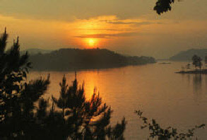
Carters Lake embraces a spectacular tract of foothills scenery in the Blue Ridge Mountains of North Georgia. Its sparkling waters and rugged shoreline provide a beautiful surrounding for a variety of recreational opportunities which include camping, fishing, picnicking, boating, mountain biking and hunting.
Lake Facts
Carters Lake has 3200 surface acres and is more than 450 feet deep its 62 miles of natural shoreline boasts no private docks or developments, the lake is named after Farrish Carter who owned property nearby in the 1800's. Carters Dam is the tallest earthen dam east of Mississippi river.
Fishing
Hunting
The Coosawattee Wildlife Management Area at Carters Lake consists of approximately 6,060 acres of mountain land in Gilmer and Murray Counties. This area is open for deer hunting with archery equipment only. Small game and turkey may be hunted with firearms during open seasons (see current Georgia Hunting Regulations for season dates). The terrain is typical of the Southern Appalachian foothills and upper Piedmont region. Forest types in the Carters Lake area consist primarily of upland hardwood and mixed pine hardwood stands. Elevations range from 700 feet in valleys to 1376 feet on ridge tops. To further supplement natural sources of food for wildlife in the area, food plots have been established by the Georgia Department of Natural Resources and the Army Corps of Engineers.
GENERAL INFORMATION
Hunting is permitted on most of the public land adjacent to Carters Lake (see map). Hunting is also allowed in campgrounds (archery only) after they are closed for the season. When campground gates are closed for the winter no vehicle access is permitted. During the annual wheelchair hunt, no archery hunting will be permitted (wheelchair hunt dates posted in Georgia hunting regulations handbook). Hunters may gain access to remote areas of the lake by boat using Corps of Engineer boat ramps around the project. Developed recreation areas posted with orange safety zone signs are closed to all hunting. Please consult the Georgia Hunting and Fishing regulations for additional information.
Parks
Come enjoy a variety of recreation activities while visiting Carters Lake Day Use Areas. Carters Lake has eight day-use areas which offer a variety of recreation facilities. Day use areas are located at Woodring Branch, Doll Mountain, Harris Branch, Ridgeway, N&S Re-regulation Areas, North Bank, Damsite, and Visitor Center. In addition to individual picnic tables which are free, large picnic shelters that can accommodate groups can be reserved in advance for a fee by calling the project office at (706)334-2248. Harris Branch Park has a public beach open from early May through Labor Day. Use caution when swimming there are no lifeguards at Harris Branch. A per vehicle use fee is charged at most day use areas at Carters Lake. Fees can be paid at self deposit fee vaults or at staffed entrance stations. Visitors may also purchase an annual pass that allows vehicles to gain access at no cost to Corps day use areas.
Boating
Boaters visit Carters Lake to enjoy its solitude and scenic beauty. Whether you're in a powerboat, sailboat, or paddling along the shoreline in a canoe, Carters Lake offers everyone an enjoyable boating experience. Carters Lake has seven public boat ramps for easy access. Boat ramps are located at Damsite, Doll Mountain, Woodring Branch and Ridgeway. The re-regulation pool also has a boat launch located near the powerhouse off old Hwy 411. boaters launching outside a developed campground are required to pay a $4 launching fee or purchase an annual day use pass. No fee is required to launch at the re-regulation pool ramp. Carters Lake Marina is available to serve all your boating needs throughout the year. Cabin rentals can also be made by calling Carters Lake Marina at 706-276-4891. You can also visit the Carters Lake Marina Website at: www.carterslake.com
For Your Safety
When visiting Carters Lake, we recommend that you review
the following safety messages for a safe and enjoyable time:
Be Alert to underwater hazards such as submerged stumps, logs and rocks that are present in the lake.
Be especially careful when approaching the shoreline because depth of water will vary from time to time and place to place.
Never dive into water of unknown depth.
Be alert to hazards such as poisonous plants, insects and snakes that inhabit the woodlands.
Keep children under close supervision at all times, especially when they are in or near the water.
Wear life vests at all times.
Do not use alcohol while in, on or around the water.
File a trip plan with someone to let them know where you will be and when you plan to return.
Swim in designated swimming areas. (In all other areas except those designated "no swimming," individuals may swim at their own risk.)
Do not overload your boat. Remember, safe boating is not overloading.
Carters Lake
For Current Lake Information
Call (706)334-2248
http://carters.sam.usace.army.mil/day-use.htm
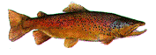
Carters Project offers fishermen diverse opportunities in terms of locations to fish and fish species. In addition to Carters Lake, anglers can fish the re-regulation pool or Coosawattee River. Carters Lake is approximately 11 miles long with 3200 acres and 62 miles of shoreline. Shoreline fishing locations are limited due to steep shoreline terrain. Boaters can access the lake via six boat ramps. Deep clear water and a rocky shoreline characterize Carters Lake. The re-regulation pool or lower lake is located below Carters Lake and can be accessed from a boat ramp near the Carters Powerhouse off Old Hwy 411. Re-regulation pool conditions (water depth and surface acres) fluctuate based on powerhouse discharge. Fishing on the lower lake is peaceful and few PWC's or pleasure boats operate on the shallow waters. Limited shoreline fishing opportunities also exist on the lower lake. Swift water fishing in the Coosawattee River can be found below the re-regulation dam. Two concrete fishing decks have been constructed along the river accessible from Old Hwy 411. Picnic tables, a hiking trail and bathrooms are also provided at the downstream fishing areas. A handicapped accessible ramp is provided on the south side fishing area. An active fish stocking program by the Georgia Department of Natural Resources along with native fish found in the lake provide diversity for anglers. Fish species include bass (largemouth, smallmouth, hybrid, stripped, spotted) crappie, walleye, bream and catfish.
